
Preview



Description
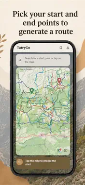
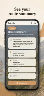
Plan your Tatra mountain hike in 30 seconds — even with no signal. TatryGo is a trail planner built specifically for the Tatra mountains, with trail maps and GPS that keep working when the signal disappears. How it works: • Choose your start point — popular trailheads like Kuźnice, Kiry or Palenica Białczańska, or any custom point on the map. • Set your available time. TatryGo generates loop proposals so you don't return the same way. • Review each proposal: distance, elevation gain, estimated time and difficulty — then save it. Trail difficulty in 3 dimensions: • Fitness — length and elevation gain. • Technical — chains, exposure and artificial aids. • Traffic — one-way trail sections. Safety first: • Avalanche warnings (TOPR scale) are checked when planning routes. • Seasonal trail closures are taken into account. On the trail: • Trail maps are built into the app and your GPS position works with no signal. • Saved plans show your position with remaining time and distance. No ads, no account required — start planning right away. Terms of Use: https://www.apple.com/legal/internet-services/itunes/dev/stdeula/
What's New
Version 0.0.23 2026-10-22
Bug fixes Technical Analysis
Package Overview Basic metadata
Bundle ID
com.danielduda.tatrygo Current Version 0.0.23
Minimum iOS 16.0
Package Size App Store Size
Package Metadata 0 / 0 version records
Detailed binary, privacy manifest, framework, and Info.plist results have not been indexed for this package yet. The verified App Store and archive metadata above remains available.
Known Version Records
0 version records with stored package metadata
Stored metadata does not guarantee a package is currently available to download.
| Details | Version / IDs | Version date | Action |
|---|