
Preview




Description
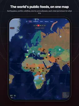
Global Sitrep puts the world's public monitoring feeds on a single map. Earthquakes from USGS. Disaster alerts from GDACS. Wildfire detections from NASA. Conflict events from UCDP and GDELT. Disease outbreaks from the WHO. Displacement figures from UNHCR. Shipping chokepoint traffic from the IMF. Live aircraft from the OpenSky Network. Each one is a public source, cited in the app, and shown for what it is. It works the moment you open it. No account, no sign-up, no subscription, and nothing is locked. Every panel, layer and source is included. THE MAP Forty-six layers over a native map: conflict zones, nuclear plants, data centres, strategic bases, submarine cables, pipelines, spaceports, chokepoints and more. Countries are shaded by an instability score that weighs conflict, unrest, hazards and coverage, not by how much data happens to exist for them. Tap any country for a briefing, any conflict zone for a dossier of what has happened there this week. LIVE FLIGHTS Aircraft positions over the area you are looking at, drawn as arrows along their ground track, with a trail of where each one has been while you were watching. Tap one for its altitude, speed, heading and aircraft type. Military aircraft are identified from public registration blocks and callsign conventions, and the app says how it knows and how confident it is. Needs a free OpenSky Network account. THE DASHBOARD Forty-three panels you can reorder, resize and hide: critical alerts, an activity timeline, regional instability rankings, seismic activity, storms, fire complexes, protests, cyber threats, market indices, commodities and prediction markets. Arrange it once and it stays that way. ALERTS AND REGIONS Set a detail level per kind of event, so you can keep every earthquake and only the major fires. Follow the countries you care about and be told when something critical happens there. Browse by region. See which sources are reporting, when each last updated, and which are quiet: an empty panel always says why it is empty. NEWS AND LIVE TV Nearly five hundred news feeds across dozens of categories, filtered to your language, plus a directory of fifty-six broadcast news channels, each of which opens in that broadcaster's own channel on YouTube. PRIVACY Global Sitrep collects nothing. There is no account, no analytics, no advertising and no tracking of any kind. Your filters and layout stay on your device. If you turn on the flights layer, the map area you are viewing is sent to the OpenSky Network to ask what is flying there, and the app tells you so on the screen where you enable it. OPTIONAL EXTRAS Thirteen of the twenty-four data sources need no setup at all. Nine more are unlocked by eight free accounts, and the app works fully without them: • NASA FIRMS - satellite fire detections, including over conflict regions • OpenSky Network - the live flights layer • Windy - webcams at map locations • abuse.ch - the botnet command-and-control feed • Copernicus - 10 m Sentinel-2 imagery on a pin • Global Fishing Watch - vessels that stopped transmitting AIS • Cloudflare Radar - internet outage detail • GIE - European gas storage Two sources need an institutional account this app cannot help you get, so they sit under Institutional access in Settings: ACLED, whose API is restricted to Research-level accounts, and ReliefWeb, which issues an app name by human review. Neither is the only route to what it carries. WHAT THIS IS NOT This is not a news alert service and not an emergency tool. Feeds are refreshed on the cadence their publishers actually update, which is minutes for earthquakes and days for some bulletins. Never rely on it for safety-critical decisions. For emergencies, follow your local authorities. There is an optional tip jar. It unlocks nothing, because the app is complete without it. Data from USGS, NASA, GDACS, UCDP, HDX, UNHCR, WHO, GDELT, IMF PortWatch, Open-Meteo, abuse.ch, the OpenSky Network and others. Full attribution is in the app.
What's New
Version 1.1 2026-09-23
The map now carries 46 layers and the dashboard 43 panels, and it all still works with no account and no sign-in. NEW ON THE MAP Satellites propagated on devic...The map now carries 46 layers and the dashboard 43 panels, and it all still works with no account and no sign-in. NEW ON THE MAP Satellites propagated on device, military aircraft, ships, oil and gas storage, trade routes, power stations, US military installations, radiation monitors, GPS interference, internet outages, weather imagery, and a day and night terminator. Submarine cables have been redrawn along their real surveyed routes: 703 cables instead of 86 approximations. OVERHEAD IMAGERY Tap a site or an event for recent imagery of that spot. Sentinel-2 at 10 m, Landsat and Sentinel at 30 m, radar that sees through cloud, night lights, live weather from GOES, and 1 m aerial photography over the United States. Every frame is dated, and the scale is stated so you know what it can and cannot show. MORE SOURCES Israeli Home Front air raid alerts, tsunami warnings, breaking reports corroborated across independent outlets before they become a pin, known exploited vulnerabilities, financial watchlists, internet censorship measurements, sanctions detail by country, and a resilience score. INSIGHTS On iOS 27 with Apple Intelligence, an optional briefing over the events already loaded. Each sentence appears above the specific records it cites, and anything that cannot be tied to a record the app is holding is discarded rather than shown. FASTER, AND QUIETER A much faster map when zoomed out, site pins that cluster instead of piling up on one city, a scale bar, a muted map style, and wildfires now default to major fires only so they no longer crowd out everything else. Technical Analysis
Package Overview Basic metadata
Bundle ID
app.worldwatch.WorldWatch Current Version 1.1
Minimum iOS 18.0
Package Size App Store Size
Package Metadata 0 / 0 version records
Detailed binary, privacy manifest, framework, and Info.plist results have not been indexed for this package yet. The verified App Store and archive metadata above remains available.
Developer Information
Known Version Records
0 version records with stored package metadata
Stored metadata does not guarantee a package is currently available to download.
| Details | Version / IDs | Version date | Action |
|---|