Preview



Description
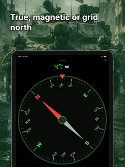
MGRS GPS turns your iPhone into a fast, glanceable military grid reference readout — built for soldiers, search-and-rescue teams, hunters, hikers, orienteers, and field researchers who think in grids and often work without a signal. Your position is shown as a large, high-contrast MGRS grid you can read at arm's length and copy with one tap. Mark waypoints, organize them into color-coded overlays, navigate with a clear bearing-and-distance display, record breadcrumb tracks, and keep working when the cell signal drops. POSITION, ANY FORMAT • MGRS / USNG military grid reference • UTM / UPS • Latitude / Longitude (decimal, DDM, DMS) • OSGB British National Grid • Show up to three formats at once • Each extra coordinate format can now be shown in its own datum MAKE IT YOURS • Choose the typeface and color of the grid readout and every data tile • Six style packs, from instrument green to a true 14-segment amber LCD • Style one tile on its own, or hand the whole screen to the readout ONE-TAP SHARING • Tap any readout to copy your grid instantly • Share via the system share sheet • Send a waypoint as a QR code WAYPOINTS & OVERLAYS • Mark your current location, a map point, or type a grid • Group waypoints into toggleable, color-coded overlays • Draw lines and polygons for routes, sectors, and boundaries • Plan multi-point routes with per-leg distance and bearing • Projected waypoints — create a point from a range and bearing off any origin • Military symbols for friendly, hostile, neutral, and unknown units MAP WITH A REAL GRID • Smooth, labeled MGRS / UTM grid overlay • Measure ruler reads distance in degrees AND mils • Range rings around your position, the map centre, or any waypoint • Area shapes — place a square, rectangle, or circle from a centre point and a size • Night vision — the whole app turns red, map included, with a one-tap switch on the Map screen NAVIGATE • Big bearing arrow, distance, cross-track, and ETA • True, magnetic, or grid north reference • Offline magnetic declination from an embedded World Magnetic Model (WMM2025) • Arrival alert with haptic feedback WORKS OFFLINE • Built-in USGS topographic, imagery, and shaded-relief basemaps • Download map areas for offline use — frame a box, pick the detail level, and see the tile count and size before it starts • Offline Maps manager: rename, delete, and see what each area costs on disk • Import your own offline maps (MBTiles raster) • Add your own tile server for coverage outside the US • Core navigation works with no cell signal TRACK RECORDING • Record breadcrumb tracks with distance, elevation gain, and time • Export tracks as GPX IMPORT & EXPORT • Full GPX import / export (waypoints + tracks) • KML and CSV import / export APPLE WATCH • Glance at your grid and bearing on your wrist PRIVATE BY DESIGN • No ads • No subscriptions • No accounts, no cloud sign-in • No analytics SDKs or third-party trackers • Your data stays on your device MGRS GPS is a one-time purchase — every feature is included. No subscriptions, no in-app purchases, and no ads, ever. Not certified for aviation, marine, surveying, live-fire, or military operations. Always carry a backup means of navigation.
What's New
Version 1.3 2026-09-06
What's new: • Choose the typeface and color of the grid readout and every data tile • Six style packs, from instrument green to a true 14-segment amber LCD • L...What's new: • Choose the typeface and color of the grid readout and every data tile • Six style packs, from instrument green to a true 14-segment amber LCD • Long-press any tile to give just that one its own font, color or size • Home layout — alignment, split rows, the label row, tile columns and height, plus a minimal mode • Night vision still overrides everything, and colors too pale for the light theme are darkened automatically • The home screen now scrolls in portrait, and the map's search button sits beside the coordinate pill No ads, no subscriptions, no tracking. Feedback is welcome! Technical Analysis
Package Overview Basic metadata
Bundle ID
com.fdddf.MGRS Current Version 1.3
Minimum iOS 18.0
Package Size App Store Size
Package Metadata 0 / 0 version records
Detailed binary, privacy manifest, framework, and Info.plist results have not been indexed for this package yet. The verified App Store and archive metadata above remains available.
Price History (USA store)
3 recorded price change points. These are historical observations, not a guarantee of the current price.
| Recorded at | Price | Currency |
|---|---|---|
| 12.99 | USD | |
| 9.99 | USD | |
| 12.99 | USD |
Developer Information
Known Version Records
0 version records with stored package metadata
Stored metadata does not guarantee a package is currently available to download.
| Details | Version / IDs | Version date | Action |
|---|