
Preview










Description
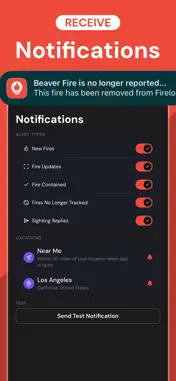
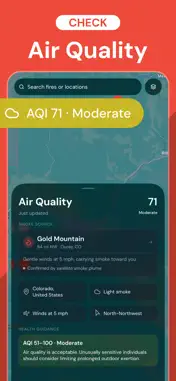
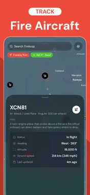
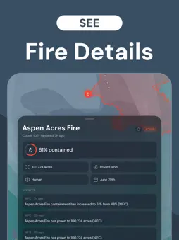
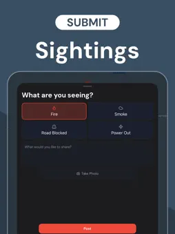
Fireloop is a wildfire tracker designed to keep you informed and safe. Easily track fires near you and see smoke and air quality on a fire map that's easy to understand. Our app uses official government data and includes on-the-ground reports from people in your community. Real-Time Wildfire Tracking: - Watch fires with official fire perimeters and status updates from U.S. wildfire agencies - Follow a fire's full timeline as it develops (growth, containment, responding agency, and more) - Locate fires that are active, contained, or planned Fire Smoke Map: - See smoke coverage on the map, shown by density (light, medium, heavy) - Check wind speed and direction to see which way smoke is heading Air Quality: - Check your current air quality or the air quality at any active fire - See PM2.5 levels and health guidance based on current conditions - Know exactly how fresh the data is, with a live "updated X min ago" timestamp Push Notifications: - Get notified when a fire is reported, grows, or reaches containment - Choose exactly which alerts you get (new fires, acreage updates, containment, and more) - Receive alerts for fires near you and near any location you save Community Sightings: - See photos and reports submitted by people near the fires - Submit your own sighting (fire, smoke, road closures, or power outages) to help others stay informed - Reply to what others post Multiple Locations: - Mark the locations that matter most, like your family - See live fire counts and air quality at a glance for every saved location Firefighting Aircraft Tracking: - See air tankers, scoopers, and helicopters responding to fires near you - View each aircraft's type, altitude, speed, and heading - Tap an aircraft for details on what it does Live Fire Maps: - Arizona Fire Map - California Fire Map - Colorado Fire Map - Florida Fire Map - Idaho Fire Map - Minnesota Fire Map - Montana Fire Map - Nevada Fire Map - New Mexico Fire Map - Oregon Fire Map - South Dakota Fire Map - Texas Fire Map - Utah Fire Map - Washington Fire Map - Wyoming Fire Map ...and all other U.S. states. When it comes to fires around the United States, use Fireloop to stay informed. Privacy Policy: https://fireloop.live/privacy Terms of Service: https://fireloop.live/terms EULA: https://www.apple.com/legal/internet-services/itunes/dev/stdeula/
What's New
Version 1.4 2026-08-11
Track firefighting aircraft with Fireloop+ Technical Analysis
Package Overview Basic metadata
Bundle ID
live.fireloop.Fireloop Current Version 1.4
Minimum iOS 26.0
Package Size App Store Size
Package Metadata 0 / 4 version records
Detailed binary, privacy manifest, framework, and Info.plist results have not been indexed for this package yet. The verified App Store and archive metadata above remains available.
Known Version Records
0 version records with stored package metadata • 4 known version records
Stored metadata does not guarantee a package is currently available to download.
| Details | Version / IDs | Version date | Action |
|---|---|---|---|
| Not archived | App Store ID: 888482834 | Unknown | Request Version |
| Not archived | App Store ID: 888322162 | Unknown | Request Version |
| Not archived | App Store ID: 887929553 | Unknown | Request Version |
| Not archived | App Store ID: 887578640 | Unknown | Request Version |