Preview



Description
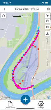
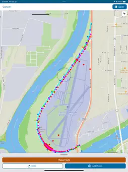
Mobile levee inspections and field data collection. Levee Inspection System 3 (LIS) is a mobile mapping and data collection app for inspecting levees and documenting flood-risk conditions. It supports levee owners and operators, inspectors, state and local agencies, Tribal governments, engineering consultants, U.S. Army Corps of Engineers (USACE) personnel, emergency management professionals, and others involved in levee safety and flood-risk reduction. LIS enables users to access levee information, navigate interactive maps, record observations and findings, and document flood, damage, or hazardous conditions. Offline capabilities support inspections in remote or disconnected areas, with collected data available to synchronize when connectivity is restored. LIS works with thousands of levee segments and systems represented in the National Levee Database (NLD). Available information varies by levee, location, account permissions, and the data maintained in the NLD. Conduct levee inspections - Access levee segments and systems available to your account. - Follow structured workflows for consistent inspections. - Record observations and findings in the field. - Document flood, damage, and other hazardous conditions. - Identify the active inspection, segment, or system while working. Explore levee information with interactive maps - View levee segments, systems, and available geographic information. - Use map layers to understand levee features and surrounding conditions. - Turn individual segment layers on or off to focus on relevant information. - Use the dynamic map legend to identify displayed features. - Adjust the amount of NLD information downloaded to your device. Work offline - Continue inspections in areas with limited or no network connectivity. - Access previously downloaded levee and map information while disconnected. - Capture inspection information offline and synchronize it when connectivity is restored. Connect with the National Levee Database Inspection data can be synchronized with the NLD, where users with the appropriate permissions can review and monitor information and create reports and maps. Access to specific levee records, inspections, synchronization, and reporting features requires an NLD account and may depend on the user’s role and permissions. Account requirements LIS is publicly available to levee professionals and organizations involved in levee ownership, operation, inspection, maintenance, emergency management, and flood-risk reduction. Users may represent independent public agencies, Tribal governments, consulting firms, private levee owners, and other eligible organizations. An NLD account and appropriate permissions are required to access protected records, conduct inspections, synchronize data, or use reporting features. For information about the National Levee Database or how to request an account, visit: https://nld.sec.usace.army.mil
Technical Analysis
Package Overview Basic metadata
Bundle ID
com.usace.leveeinspectionsystem Current Version 7.0.0
Minimum iOS 15.5
Package Size App Store Size
Package Metadata 0 / 0 version records
Detailed binary, privacy manifest, framework, and Info.plist results have not been indexed for this package yet. The verified App Store and archive metadata above remains available.
Known Version Records
0 version records with stored package metadata
Stored metadata does not guarantee a package is currently available to download.
| Details | Version / IDs | Version date | Action |
|---|