
Preview




Description
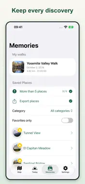
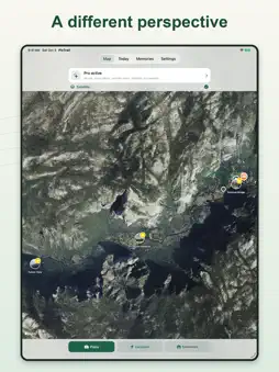
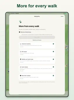
Your favorite places have a story. Keep it with PixTrail: add photos and notes to your discoveries and find them again on your personal map. For a trip, a getaway or a walk around your neighborhood: • Save up to five places for free, with photos and notes. • Organize memories with free categories, favorites, search and filters. • Record walks and review your route, duration and distance. • Link places and photos to each walk to relive it later. • Save your parked car or starting point and open directions back. • Check estimated altitude, the compass and weather before heading out. MORE FROM EVERY WALK Unlock a utility with a rewarded ad and enjoy it for 30 minutes. Each utility has its own timer. Places you save remain after temporary access ends. Temporary access does not remove ads. PIXTRAIL PRO: EVERYTHING IN ONE PURCHASE No subscription. Remove ads and get every utility: save more than five places, satellite and hybrid maps, advanced statistics, GPX walk export and GeoJSON place export. Places, photos and walks are stored on your device. Background location is used only while recording a walk. Altitude and ascent are estimates. Maps, weather and directions may require an internet connection. PixTrail uses Apple maps. Directions to saved places can open in Apple Maps, Google Maps or Waze; directions back to your car use Apple Maps. These services are subject to their own terms and privacy policies.
What's New
Version 2.1 2026-10-06
• Fixed an issue in Memories and Settings that hid the title and caused unexpected layout movement while scrolling. Technical Analysis
Package Overview Basic metadata
Bundle ID
casaxmore.PixTrail Current Version 2.1
Minimum iOS 17.5
Package Size App Store Size
Package Metadata 1 / 6 version records
Detailed binary, privacy manifest, framework, and Info.plist results have not been indexed for this package yet. The verified App Store and archive metadata above remains available.
Developer Information
Known Version Records
1 version record with stored package metadata • 6 known version records
Stored metadata does not guarantee a package is currently available to download.
| Details | Version / IDs | Version date | Action |
|---|---|---|---|
| 5.0 MB | v1.5 App Store ID: 888283660Build: 1.5 | 2026-07-27 00:25:34 | Get Version |
| Not archived | App Store ID: 887590147 | Unknown | Request Version |
| Not archived | App Store ID: 885896117 | Unknown | Request Version |
| Not archived | App Store ID: 885642445 | Unknown | Request Version |
| Not archived | App Store ID: 885587483 | Unknown | Request Version |
| Not archived | App Store ID: 874690415 | Unknown | Request Version |