
Preview







Description
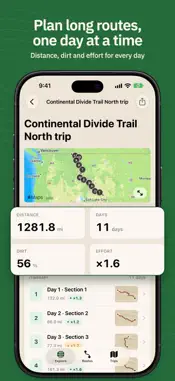
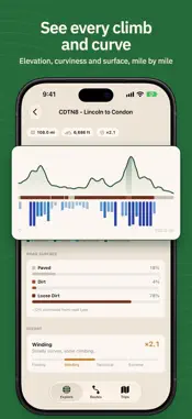
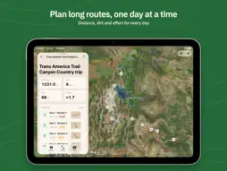
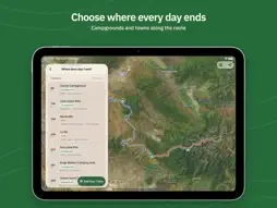
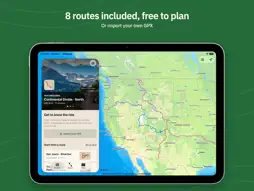
Split a long backcountry route into days you can actually travel: where each day ends, how much of it is dirt, how hard it is, and where you'll camp. GPXplore is built for adventure motorcycle riders on routes like the Trans-America Trail and the Backcountry Discovery Routes (BDRs). If you're overlanding, bikepacking or hiking a long route in stages, the same planning works for you too - try it and tell us what would make it better. No account, no sign-in. Your routes and trips stay on your iPhone. START WITH 8 ROUTES, FREE TO PLAN • Five segments of the Trans-America Trail, the Continental Divide north and south, and the San Juans ship with the app. • See each route on the map with its sections, road surface (paved or dirt), effort and campgrounds along the way. BRING YOUR OWN GPX • Open a .gpx file from Files, Mail, AirDrop or the share sheet and it lands in your Routes, ready to plan. PLAN EVERY DAY • Split a route into days and choose where each day ends: a campground, dispersed camping or a town along the way. • Each day shows its distance, dirt percentage, effort and elevation, so you can balance long days against hard ones. (Dirt and effort come with the included routes; add them to your own routes with Premium.) • Scan the itinerary to see where every day ends and which days you've already reviewed, then save the trip. TAKE IT WITH YOU • Open a saved trip to see each day's map, distance, surface, elevation and places. • Add notes and places to any day. • Export a day or a whole trip as GPX for your GPS, or share the complete trip with a travel partner. • Saved trips open without a signal. STAY AWARE • Turn on the wildfire layer to see active fire detections and perimeters near your route. • Campground, place and wildfire information is for planning. Always check closures and conditions with the land manager before you go. GPXPLORE PREMIUM An optional auto-renewing subscription, billed monthly or yearly, that adds: • Surface and effort data for any route you import • Roads out to stops off the route, and routing across gaps • More than one route in a single trip • Starting or finishing a route anywhere along it (preview) • A short written read for each day of your trip Everything you make with Premium stays in your trips and exports if your subscription ends. Road surface data covers the continental United States, British Columbia and Alberta. Route data and maps need a connection. Payment is charged to your Apple Account at confirmation. Subscriptions renew automatically unless cancelled at least 24 hours before the end of the current period. Manage or cancel them in your Apple Account settings. GPXplore is a planning tool, not a navigation device. Backcountry travel is dangerous: carry proper maps, check official sources and use your own judgement. Terms of Use: https://www.gpxplore.net/terms Privacy Policy: https://www.gpxplore.net/privacy
What's New
Version 1.1 2026-10-12
GPXplore now runs on iPad and iPhone Duo. • Plan beside the map: on iPad and Duo, the route map fills the screen and your trip, day or stop sits in a panel alo... Technical Analysis
Package Overview Basic metadata
Bundle ID
net.gpxplore.app Current Version 1.1
Minimum iOS 27.0
Package Size App Store Size
Package Metadata 0 / 0 version records
Detailed binary, privacy manifest, framework, and Info.plist results have not been indexed for this package yet. The verified App Store and archive metadata above remains available.
Developer Information
Known Version Records
0 version records with stored package metadata
Stored metadata does not guarantee a package is currently available to download.
| Details | Version / IDs | Version date | Action |
|---|