
Preview







Description
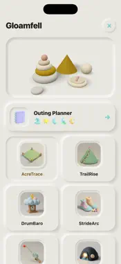
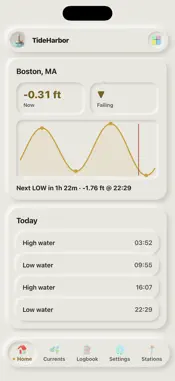
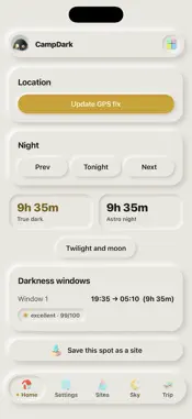
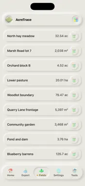
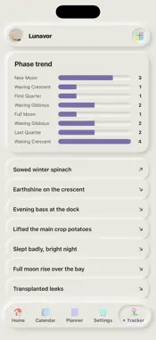
Plan a field day around the tide, the light and the dark. Gloamfell puts 13 offline outdoor tools on your phone, built on GPS and the phone's own sensors, plus an Outing Planner that lines up tides, sun, moon, darkness and solunar times for a place, with on-device reminders. OUTING PLANNER - One day timeline per place with five bands: tide, sun, moon, darkest window and solunar times - Bring in places from your saved campsites, sky sites, moon locations and tide stations - Save trips with a checklist and notes - Reminders before high tide, low tide, golden hour, darkness and solunar major periods, scheduled on the device - A 3D Sky Dome of the sky over your place - Export a trip to your calendar or as a printable page THE 13 TOOLS - TideHarbor: offline tide predictions for 116 US NOAA stations, with the day's curve, highs and lows, live height and a countdown to the next tide - WayDrop: drop a GPS mark and walk back to it with a live distance and bearing arrow, chain marks into a trip, read DMS, UTM and MGRS - AcreTrace: measure area, perimeter and distance by walking a boundary or tapping points, export KML, GPX, CSV or GeoJSON - TrailRise: barometric altimeter and hike recorder with gain, loss and climb rate - DrumBaro: pocket barometer with pressure tendency, a storm-onset alert and a weather-trend log - StrideArc: pace-count distance with personal calibration and step sensing - BiteWindow: solunar major and minor feeding periods, a day rating, spots and a catch logbook - CampDark: tonight's dusk, true darkness and moon for a campsite, with a darkest-hours timeline - Lunavor: moon phase, rise and set for any date, a moon calendar and a night planner - LumiereHours: sunrise, sunset, golden and blue hour and every twilight stage, with a sun-path and shadow simulator - LumaStop: exposure triangle and key-to-fill lighting planner with manual EV entry - Nightfield: live star chart from the motion sensors, with 201 stars, 32 constellations, tap to identify and a red-light mode - SkyPhase: deep-sky catalog with rise and set times, saved targets and a night run-sheet FREE TO TRY Every tool opens and does its core job for free. Live GPS, altitude, pressure and sky readings, today's tides for every built-in station, tonight's darkness and moon, and every safety reading are never locked. Free use includes 3 saved items in most tools, the newest 7 entries of every log, forecasts for today plus 2 days, and one sample export per tool. UNLOCK EVERYTHING One purchase unlocks all 13 tools and the Outing Planner: unlimited saved fields, marks, spots, stations, sites and trips, full logbooks, longer forecasts and planning dates, the full deep-sky and Messier catalogs, every coordinate format, every alert type for every place, and every CSV, PDF, GPX, KML and calendar export. One-time purchase, no subscription. Bought anything in Gloamfell before? It still unlocks everything. Use Restore purchases in Settings. PRIVATE AND OFFLINE No account and no sign-in. Your places, logs and plans stay on your device, and the tools work without a connection. Location is used only while the app is open. Reminders are scheduled on the device; there is no push server. Tide predictions are for planning and reference only and are not for navigation. Solunar, darkness and sky times are estimates. Made by bee2.io LLC. More apps at bee2.io
What's New
Version 1.2.0 2026-11-03
- New Outing Planner: tide, sun, moon, darkness and solunar times for a place on one timeline, saved trips, on-device reminders and a 3D Sky Dome. - Tide predic...- New Outing Planner: tide, sun, moon, darkness and solunar times for a place on one timeline, saved trips, on-device reminders and a 3D Sky Dome. - Tide predictions now computed from official NOAA harmonic constants for 116 US stations and checked against NOAA's published highs and lows. - One unlock now opens every tool, and the free level is more generous in most tools. Earlier purchases still unlock everything. - Safer saving, a full station picker and many fixes. Technical Analysis
Package Overview Basic metadata
Bundle ID
io.bee2.gloamfell Current Version 1.2.0
Minimum iOS 16.4
Package Size App Store Size
Package Metadata 0 / 0 version records
Detailed binary, privacy manifest, framework, and Info.plist results have not been indexed for this package yet. The verified App Store and archive metadata above remains available.
Developer Information
Known Version Records
0 version records with stored package metadata
Stored metadata does not guarantee a package is currently available to download.
| Details | Version / IDs | Version date | Action |
|---|