Preview






Description
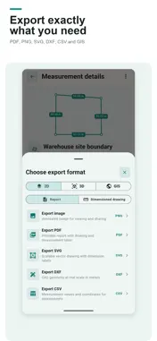
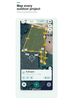
Measure distance with an AR tape measure and calculate land area on GPS maps. GMeasure AR combines camera-based AR measurement with GPS mapping tools. Measure objects, rooms, and outdoor spaces, save your results, and export them for your next project. FREE VERSION AND OPTIONAL PREMIUM AR camera and GPS map measurement tools are available without a purchase or subscription. The free version includes ads, one project, and up to three folders per project. Removing ads and creating unlimited projects and folders require a paid Premium subscription, available as a monthly or yearly in-app purchase. Premium is optional and is not required to use the measurement tools. Subscriptions renew automatically unless canceled. Manage or cancel your subscription in your App Store account settings. AR CAMERA MEASURING TOOLS • Measure distance, length, and multi-segment paths • Measure height, slope, level, and angles • Measure room, floor, polygon, and rectangle areas • Measure circles, radius, circumference, and cylinders • Calculate the volume of boxes and other shapes from measured points • Measure openings and parallel distances for doors, windows, or walls • See measurement lines, points, side lengths, and area on the live camera view GPS LAND AREA MEASUREMENT • Walk around a boundary to record coordinates with GPS • Move the map crosshair to place boundary points manually • Measure distance and area, or estimate volume by entering a height • View side lengths, perimeter, and coordinates • See all saved measurements on a map SAVE AND ORGANIZE YOUR WORK Save one object or a set of objects with a name, reference code, details, color, images, date, and coordinates. Edit saved information or shapes, view individual objects in 3D, or place a saved shape back into AR. The free version supports one project and up to three folders per project. Unlimited projects and folders require a paid Premium subscription. EXPORT AND SHARE • PNG images and PDF reports for clients or team members • CSV for spreadsheet data • SVG and DXF for 2D drawings and CAD • GLB, OBJ, and STL for 3D work • KML and KMZ for Google Earth or GIS software, including saved coordinates and available images MULTIPLE MEASUREMENT UNITS Choose length, area, and volume units, including millimeters, centimeters, meters, kilometers, inches, feet, yards, miles, square meters, acres, and cubic meters. Thai land units such as rai, ngan, and square wah are also supported. USE GMEASURE AR TO • Measure rooms, walls, floors, doors, windows, and furniture • Plan renovations, interior layouts, or material purchases • Record on-site dimensions and share them with your team • Estimate the area of gardens, fields, land plots, and outdoor spaces • Prepare coordinate data for Google Earth and GIS IMPORTANT INFORMATION Measurements are estimates. Accuracy depends on your device, lighting, surface conditions, camera movement, and GPS signal quality. Verify results with standard measuring equipment before using them for construction, engineering, legal property boundaries, or official documents. AR features require an iPhone or iPad that supports ARKit. Map measurement requires location permission and may require an internet connection. Terms of Use: https://www.apple.com/legal/internet-services/itunes/dev/stdeula/
Technical Analysis
Package Overview Basic metadata
Bundle ID
com.toptoshirou.ar.ruler.measure.tape.area.length.camera.tools.gmeasurear Current Version 1.0.0
Minimum iOS 15.0
Package Size App Store Size
Package Metadata 0 / 0 version records
Detailed binary, privacy manifest, framework, and Info.plist results have not been indexed for this package yet. The verified App Store and archive metadata above remains available.
Developer Information
Known Version Records
0 version records with stored package metadata
Stored metadata does not guarantee a package is currently available to download.
| Details | Version / IDs | Version date | Action |
|---|