Preview









Description
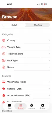
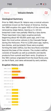
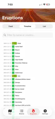
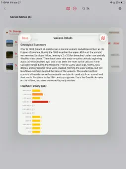
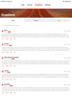
Explore over 4,575 volcanoes across 118 countries with 11,000+ eruption records. VolcanoMap combines the Smithsonian Global Volcanism Program's definitive database with live weekly activity reports in one powerful app. INTERACTIVE MAP Color-coded pins show active, dormant, and extinct volcanoes worldwide. Filter by Active, Notable, or those with Photos. Combine filters with intuitive Venn diagram controls. Toggle the Ring of Fire and tectonic plate boundaries as map overlays. LIVE VOLCANIC ACTIVITY The Eruptions tab delivers the Smithsonian's weekly volcanic activity report directly to your phone. See which volcanoes are currently active worldwide, with full activity descriptions and one-tap navigation to details or the map. ERUPTION TIMELINE Every volcano's eruption history visualized as a color-coded bar chart using the Volcanic Explosivity Index (VEI). Over 11,000 eruption records spanning thousands of years. See the 50 most recent eruptions across all volcanoes in timeline or list view. VEI SCALE Each eruption is rated 0-8 on the Volcanic Explosivity Index, color-coded from green to dark red. Contextual comparisons explain the scale — from gentle Kilauea lava flows (VEI 0) to Tambora-scale super-colossal events (VEI 7). BROWSE & DISCOVER Explore by country, volcano type, tectonic setting, rock type, or status. View pie chart statistics. Over 1,880 volcanoes include photos. 1,185 link to Wikipedia articles. Try a random volcano to discover something new. NEAR ME Find nearby volcanoes sorted by distance. Get driving directions via Apple Maps. Use the live compass radar to see volcanoes around you in real time. Switch between list, map, and compass views. PHOTOS & DETAILS Detailed information including elevation, last eruption year, VEI with scale comparison, tectonic setting, rock type, eruption count, and full geological summaries from the Smithsonian. Satellite view, directions, and sharing built in. COMPREHENSIVE DATA Built on the Smithsonian Global Volcanism Program's Volcanoes of the World database — the global authority on volcanic activity. Enriched with photos and Wikipedia links from Wikidata. 2,661 volcanoes from the Smithsonian plus 1,914 additional from Wikidata. All volcano data is included in the app. No internet connection required for core features — only the live weekly feed and photo loading need internet. No account needed. No ads, no tracking.
Technical Analysis
Package Overview Basic metadata
Bundle ID
arcticsurf.VolcanoMap Current Version 1.0
Minimum iOS 17.6
Package Size App Store Size
Package Metadata 1 / 1 version records
Detailed binary, privacy manifest, framework, and Info.plist results have not been indexed for this package yet. The verified App Store and archive metadata above remains available.
Developer Information
Known Version Records
1 version record with stored package metadata
Stored metadata does not guarantee a package is currently available to download.
| Details | Version / IDs | Version date | Action |
|---|---|---|---|
| 14.49 MB | v1.0 App Store ID: 883856354Build: 1.0 | 2026-03-28 12:32:33 | Get Version |