
Preview




Description
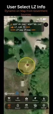
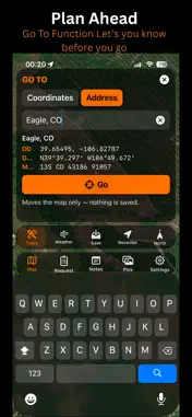
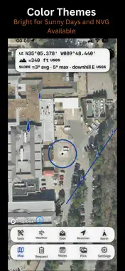
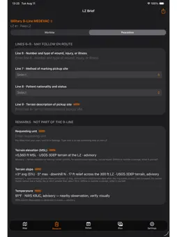
Pathfinder LZ turns any point on the map into a complete, shareable helicopter landing-zone brief — coordinates, terrain, obstacles, and weather — so ground crews and aircrews work from the same picture. The off-airport landing zone is one of the highest-risk, least-documented moments in rotary-wing operations. Pathfinder LZ standardizes it. Drop a scaled ring on the exact spot, and the app assembles everything that describes it, then hands you a clean brief you can read to an aircrew or send in seconds. BUILT FOR THE MISSION Dedicated brief formats adapt to how you work: - Civilian MEDEVAC — for HEMS and EMS ground crews - Search & Rescue — for SAR teams and incident command - Law Enforcement — for aviation units and tactical support - Military 9-Line MEDEVAC — built to doctrine, with wartime and peacetime modes THE RIGHT DATA, AT THE POINT YOU CHOOSE - Verified coordinates in DD, DDM (aviation), and MGRS — convert instantly and read the right format to the aircrew - Live weather for the landing zone, by coordinate - Terrain elevation and approximate slope at the LZ - Hazards and obstacles you mark yourself, with standard chart symbology - FAA airports and heliports, including nearby medical helipads - State and county boundaries for fast orientation - A geographically scaled landing-zone ring WORKS WHERE YOU WORK Field operations don't wait for a signal: - Download offline map areas in advance for use with no connection - Coordinates and conversions work fully offline - Four display themes — night-vision-friendly, daylight high-visibility, full color, and colorblind-safe - Share a complete brief by text or with a map image, even over low-bandwidth links - Save and manage your landing zones, with notes and geotagged photos INFORMATION, NOT A VERDICT Pathfinder LZ presents information to support your decision. It never scores, rates, or approves a landing zone — the pilot in command and qualified decision-makers retain full authority. All data is advisory and should be verified against authoritative sources and direct observation. Pathfinder LZ is not certified avionics, not an approved source of aeronautical information, and not a navigation system. SUBSCRIPTION Pathfinder LZ includes a 3-day free trial, then $4.99/month or $49.99/year. Subscriptions renew automatically unless canceled; manage or cancel anytime in your Apple ID settings. Privacy Policy: https://apexarsystems.com/pathfinderlz/privacy Terms of Use: https://apexarsystems.com/pathfinderlz/terms Pathfinder LZ is a product of Apex AR Systems, LLC.
Technical Analysis
Package Overview Basic metadata
Bundle ID
com.apexarsystems.pathfinder Current Version 1.0 (2)
Minimum iOS 17.0
Package Size App Store Size
Package Metadata 0 / 0 version records
Detailed binary, privacy manifest, framework, and Info.plist results have not been indexed for this package yet. The verified App Store and archive metadata above remains available.
Developer Information
Known Version Records
0 version records with stored package metadata
Stored metadata does not guarantee a package is currently available to download.
| Details | Version / IDs | Version date | Action |
|---|