Preview




Description
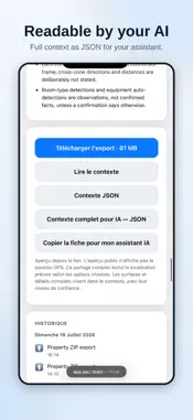
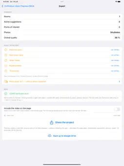
Atlas Scanner turns a site visit into a complete building record — on location, with no Internet needed. Scan room by room or floor by floor using your device's LiDAR sensor. The app produces dimensioned 2D floor plans, computes areas, and keeps everything in a per-property record you can reopen months later. **Built for field work** Large buttons, guided steps, no clutter. Every scanned zone is reviewed on screen before you accept it: you see the plan, the dimensions and a quality score before moving on. **Photos that stay tied to the place** Photograph the electrical panel, the main water valve, the water heater, the router, the thermostats. Each photo stays attached to its room and to its point of interest — no more camera roll where you can't tell which building you're looking at. **Sensor suggestions** From the surveyed geometry, the app proposes where to place sensors and explains why. Accept, move or decline — the decision stays yours. **Multiple floors, honestly linked** Connect two levels through a stairwell and orient both plans in a shared frame. The app states plainly what was measured and what you confirmed by hand — it never claims precision it doesn't have. **Export and sharing** A complete ZIP (data, dimensioned PDF plans, photos, installer report) plus a lightweight web page your client opens in a browser without installing anything. You choose what leaves the device: photos, address, location, notes — each with its own switch. Location off means location gone, including inside the photo metadata. **Works offline** Surveying, review, plans and ZIP export all work with no network. Online sharing is optional. 3D scanning requires a LiDAR-equipped device (iPhone 12 Pro or later, iPad Pro 2020 or later). On other devices you can still create properties, take photos, import a project and export — but not produce a 3D scan.
What's New
Version 2.6.107 2026-11-02
A more complete survey, and easier to correct: • LiDAR depth during the whole scan video: distance measurements travel with the video, ready for 3D reconstruct...A more complete survey, and easier to correct: • LiDAR depth during the whole scan video: distance measurements travel with the video, ready for 3D reconstruction tools. • Correct the plan by touch: "What's here?" on a wall to place a door, a window or a glass wall; door type, swing and width as large drawn cards; the scan video shows the spot. • Passages, gaps in walls, soffits and missing walls (large mirror) can be declared and found on the plan. • New scan of an area: the previous version is kept and the new scan is aligned to it; your answers follow. • True north: every scan measures the compass and the readings are combined. • Long scans: the screen stays on, "Resume" no longer erases what was already scanned, more key frames, a warning when the iPhone is low on space. • Export for 3D printing: a small file with the property model. • Pascal and IFC exports: door swing, one zone per room, openings on their real wall. Technical Analysis
Package Overview Basic metadata
Bundle ID
com.a3atlas.scanner Current Version 2.6.107
Minimum iOS 17.0
Package Size App Store Size
Package Metadata 0 / 0 version records
Detailed binary, privacy manifest, framework, and Info.plist results have not been indexed for this package yet. The verified App Store and archive metadata above remains available.
Known Version Records
0 version records with stored package metadata
Stored metadata does not guarantee a package is currently available to download.
| Details | Version / IDs | Version date | Action |
|---|