
Preview


Description
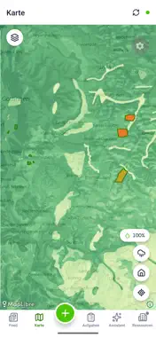
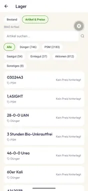
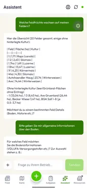
Every hectare has an optimum. agmeo finds it. It combines satellite, soil, weather and market data with a scientific crop growth model — and turns all of it into one clear answer: what is worth doing, where, and when. THE FULL PICTURE Import in any format. agmeo brings every file you have onto one standard and adds live soil, weather and vegetation data on top. The result: Zone-specific maps for sowing, fertilisation, crop protection, irrigation and harvest, each with a risk assessment for drought, waterlogging, erosion and trafficability. EVERYTHING UNDER CONTROL From field to application map, hectare by hectare, sent straight to your terminal or to the John Deere Operations Center. Every recommendation open to adjustment before it leaves your hands. FULL INDEPENDENCE Your nitrogen recommendation should not come from the party selling the nitrogen. agmeo holds no interest in the quantity — the model answers to the crop and to the market. And your data belongs to you. Programmed, hosted, collected and analysed in Germany, GDPR-compliant. Independent. On principle. AUDIT-PROOF RECORDS Complete documentation for fertiliser regulation, crop protection and funding requirements. Target-actual benchmarking and a 20-year comparison show what worked where — and what did not. BASED ON SCIENCE. BUILT FOR THE FIELD. Founded out of research at the Universities of Göttingen and Erlangen, building patented technology since 2020.
Technical Analysis
Package Overview Basic metadata
Bundle ID
com.agmeo.field Current Version 1.1
Minimum iOS 16.4
Package Size App Store Size
Package Metadata 0 / 0 version records
Detailed binary, privacy manifest, framework, and Info.plist results have not been indexed for this package yet. The verified App Store and archive metadata above remains available.
Known Version Records
0 version records with stored package metadata
Stored metadata does not guarantee a package is currently available to download.
| Details | Version / IDs | Version date | Action |
|---|