
Preview





Description
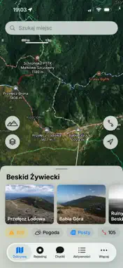
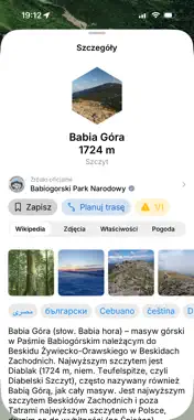
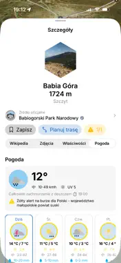
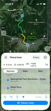
On Trail is your companion in the mountains — trail navigation, an activity tracker and a route planner in one, with offline maps that work with no signal. MAPS & EXPLORATION • Detailed trail maps based on OpenStreetMap, available offline • Thousands of points: peaks, mountain huts, passes, springs, parking • Place cards with photos, descriptions and up-to-date community remarks • EAWS avalanche warning layer ACTIVITY TRACKING • On foot (hike, trail run, nordic walking), skiing (ski tour, downhill) and cycling (MTB, gravel, road) • Distance, time, speed, elevation gain and an elevation profile • Barometric altitude, heart rate from a BLE sensor and calorie estimates • GPX route import ROUTE PLANNING • Add points from the map or search, calculate distance and time • Elevation profile and SAC difficulty scale • Plan by voice with the AI assistant: "a route from A to the summit" AI ASSISTANT • A multi-turn chat about mountains, weather, trails and your activities • Photo analysis plus route and viewpoint suggestions WEATHER & SAFETY • Meteoblue weather forecast that accounts for altitude • EAWS avalanche danger (levels 1–5) • Storm, wind and sunset alerts • Regional mountain-rescue emergency numbers COMMUNITY • Share activities, photos and trail-condition remarks • Comments, reactions and friends • Automatic flora and fauna recognition in photos • Report inappropriate content and block abusive users OFFLINE REGIONS The Tatras, Beskids, Pieniny, Karkonosze and Bieszczady, plus the Alps (Italy, Austria), Croatia and US national parks (Yosemite, Yellowstone, Zion, Grand Canyon and more). You can also generate your own map of any region. Core features are free. Advanced capabilities are available in premium packages (SPORT, EXPLORER, HEALTH) via subscription — with a one-time 3-day free trial. The subscription renews automatically unless cancelled at least 24 hours before the end of the current period. Payment is charged to your Apple ID account. Manage or cancel your subscription in App Store settings. Privacy Policy: https://weiga.pl/na-szlaku/#privacy_policy Terms of Use (EULA): https://weiga.pl/warunki-uzytkowania-na-szlaku/
What's New
Version 1.4.4 2026-11-13
Users' posts and warnings Technical Analysis
Package Overview Basic metadata
Bundle ID
pl.weiga.ontrail Current Version 1.4.4
Minimum iOS 17.6
Package Size App Store Size
Package Metadata 0 / 0 version records
Detailed binary, privacy manifest, framework, and Info.plist results have not been indexed for this package yet. The verified App Store and archive metadata above remains available.
Developer Information
Known Version Records
0 version records with stored package metadata
Stored metadata does not guarantee a package is currently available to download.
| Details | Version / IDs | Version date | Action |
|---|