Preview

Description
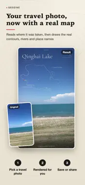
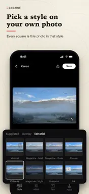
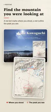
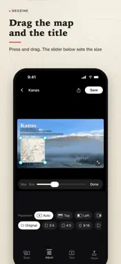
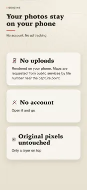
Pick a travel photo with a location. GeoZine reads where it was taken and draws the real contours, rivers and place names there, laid into one image you can post as is. A red dot marks where you stood, and one line under the title says where you are and what you are looking at. THREE STEPS 1. Pick a travel photo. Choose one that has a location. No location? Search for a place name or tap the map instead. 2. The place is drawn automatically. GeoZine reads the capture point and draws the real contours, rivers and place names there. 3. Pick a ratio, save or share. Original, 3:4, 4:5, 9:16 and 1:1, and the title and map block can be dragged wherever you like. THE DEFAULT SPOTLIGHT LAYOUT The map is the hero: the mountain or lake you are looking at is picked out in red, and the title is followed by coordinates, elevation and heading, plus one line that says where you stand and what you see. Classic, Ink and Minimal styles are still there. You can also export a magazine page: the photo is kept exactly as shot, with a paper-colored page added beside it for the title, coordinates, elevation, heading, date, a short caption and the full map. WHY THE IMAGE CAN BE TRUSTED - Contours drawn from real elevation data: they come from public elevation data, peaks carry their heights and lakes follow real shorelines. It is not an illustration. - A red dot and a line you can verify: the dot is the photo's capture point, so anyone can check it. - Your original pixels are never changed: GeoZine only lays a layer over the photo, and everything outside the map matches the original pixel for pixel. - Photos are processed on your phone and never uploaded. No account, no ad tracking. GOOD TO KNOW - An internet connection is needed each time. GeoZine downloads public map and elevation data near the capture point, usually in under half a minute. The requests contain only map tile numbers near that point, never your photo. - GeoZine draws terrain, water, roads and place names. It deliberately draws no national borders or administrative boundary lines. - Map data © OpenStreetMap contributors, OpenFreeMap. Elevation data: AWS Terrain Tiles. Questions and ideas: [email protected]
What's New
Version 1.3.6 2026-11-13
GeoZine 1.3.6: turn a landscape photo into a portrait image without cropping it. • Pick a taller ratio such as 3:4 or 4:5 and the whole photo stays at the bott...GeoZine 1.3.6: turn a landscape photo into a portrait image without cropping it. • Pick a taller ratio such as 3:4 or 4:5 and the whole photo stays at the bottom while the sky extends upward, with the map and title placed in the new sky • Sharing to Xiaohongshu saves two images at once: a portrait cover and a before and after comparison. Pick the cover first • Sharing uses the ratio you chose in the editor, and the editor stays as it was afterward • In Adjust, switch between Extend sky and Crop next to the ratios Technical Analysis
Package Overview Basic metadata
Bundle ID
com.gatheon.geozine Current Version 1.3.6
Minimum iOS 17.0
Package Size App Store Size
Package Metadata 0 / 0 version records
Detailed binary, privacy manifest, framework, and Info.plist results have not been indexed for this package yet. The verified App Store and archive metadata above remains available.
Developer Information
Known Version Records
0 version records with stored package metadata
Stored metadata does not guarantee a package is currently available to download.
| Details | Version / IDs | Version date | Action |
|---|